Sai Kung is a stunning region in Hong Kong with many beautiful slices of nature waiting for you to discover. But which hike should you do? How do you get there? Where are the best beaches?
From winter hikes to summer snorkeling spots, this Sai Kung Nature Guide has something for you to do in Sai Kung year-around.
What do I get?
41+ Amazing destinations
41+ Islands, beaches, and hiking trails waiting for you to discover in this comprehensive guide over 180 pages long.
Never get lost on a hike again!
Each hiking trail has a GPX file for you to download. You can import it (I recommend OSMAND) and simply follow the route!
Photo + hand drawn map overviews
I included all essential (and pretty) photos of each place as well as handdrawn map to make sure nothing is missing.
Interactive eguide
Navigation through the guide is made easy with links and themed lists so you never have to scroll through the whole pdf looking for one hike.
Hi, my name is Nam and I’ve been living 20 minutes from Sai Kung since I was 9. I spent a lot of my life before 2015 studying in the UK, graduating with a MSci of Geology and an appreciation to mountains and nature.
I moved back to Hong Kong after graduation and have been discovering Sai Kung, the most beautiful ‘back garden’ of Hong Kong. It is arguably the prettiest region in the whole of Hong Kong and I spend almost every weekend going to pristine beaches, on stunning hikes, and visiting hidden islands. While I’ve been writing all about Hong Kong’s many nature spots on my blog, I realise that I want to dig deeper and make a comprehensive guide for people who want to go deeper, too.
The whole thing took longer than I thought but I’m so excited to share 36+ islands, beaches, and routes in this guide. And I’ll strive to add to it as I explore my turf some more.
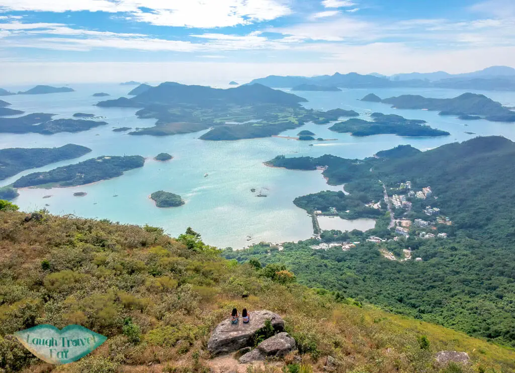
Sai Kung not only has a Geological Park with hexagonal columns, it is also a marine park with the best water quality in the whole of Hong Kong. Because it cannot be reached by MTR or rails, and many areas have restricted access, it means that it is less polluted and developed. It is also the start of the MacLehose Trail, which spans over 100 km in Hong Kong. But there are also many trails that are lesser known, some I haven’t even covered on my blog!
Note: this is an eguide and will be available for download immediately after purchase
184 pages of information by yours truly – including essential information on getting in and around Sai Kung, 37+ islands/beaches/hiking trails as well.
It’s for anyone who wants to explore Sai Kung, people who are new to Hong Kong, beginner hikers who aren’t sure of which hikes to do, and those who’ve searched the internet but find the information available too simplistic (trust me, I’ve been there too). If you want to be very well prepped on your hike, this guide is for you!
Note: if you are an experienced hiker – then perhaps you don’t need such a detailed guide.
The guide is regularly updated by me, with new hikes added as I explore even more of Sai Kung! You can sign up for optional email notices to receive a new version when it is updated once you’ve purchased the guide.
As much as I would love to provide everything for free, I too need to pay bills! This is for my 5 years of hiking expertise and weeks and months of work in putting them together. Think of this as me being your tour guide without actually being physically present.
Since there are over 36 unique locations on the guide, it means you are only paying 2-3 HKD each!
I want to include every single note-worthy location but not every single one of them need that much information. For example, the beautiful Ham Tin Beach and Tai Wan Beach are amazing to visit, but once you get there, you only tan so there isn’t any extra info. Whereas enroute to Long Ke, you can stop by East Dam, which makes its section much longer.

 中文 (香港)